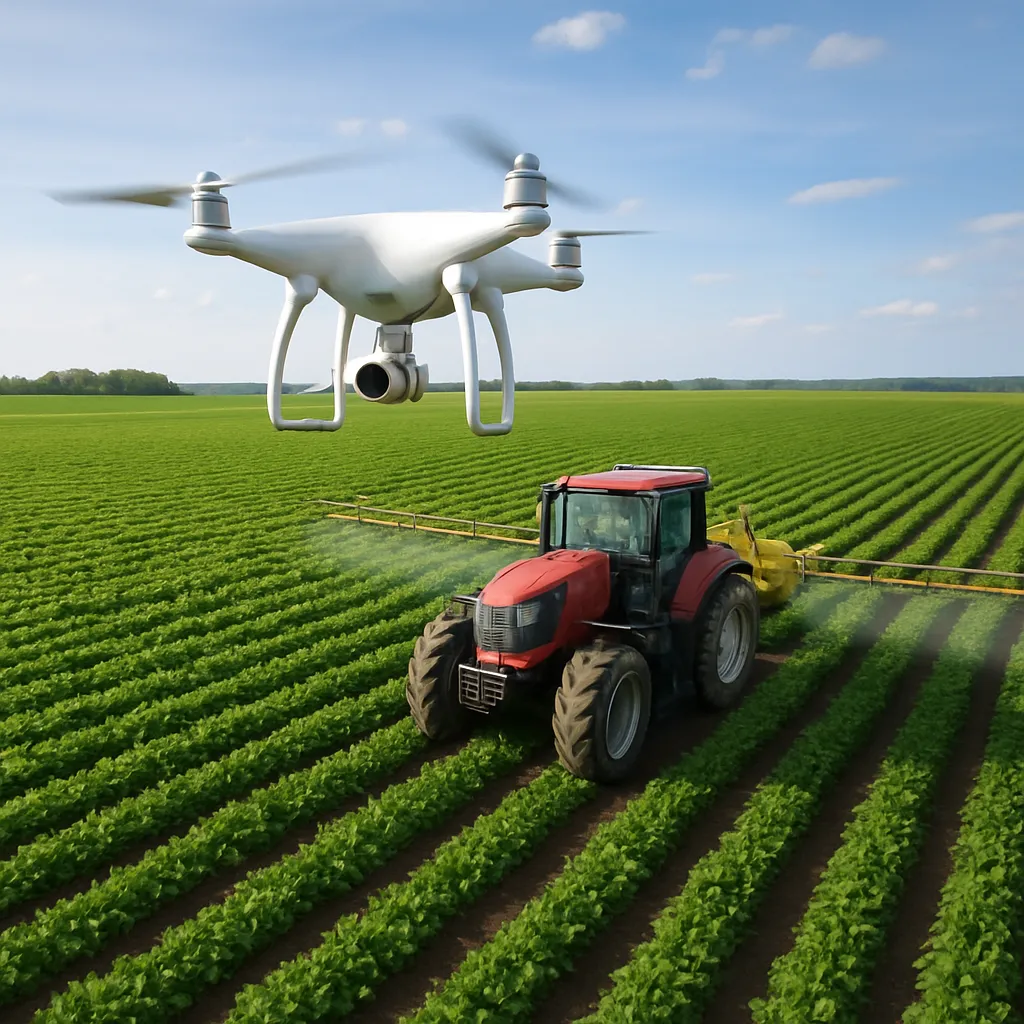
Precision farming has reached new heights thanks to the synergy between drones and tractors. By combining aerial perspectives with ground-based power, modern farmers can achieve unprecedented levels of efficiency and accuracy in field operations. This article explores the essential components of integrating unmanned aerial vehicles (UAVs) with heavy machinery, examines the underlying technologies, and offers practical guidelines for maximizing the benefits of this powerful partnership.
Benefits of Integrating Drones and Tractors
Pairing drones with tractors unlocks numerous advantages that enhance crop monitoring, resource management, and overall farm productivity. Below are several key benefits:
- Mapping Precision: High-resolution aerial imagery from drones yields detailed crop maps that guide tractor-based operations like planting and fertilizing.
- Improved Pest and Disease Detection: Drones equipped with multispectral cameras spot stress indicators early, enabling rapid treatment with tractor-mounted sprayers.
- Variable-rate Application: Data-driven prescriptions generated from drone surveys allow tractors to apply water, fertilizers, or pesticides at variable rates, reducing waste and optimizing yields.
- Time Savings: Aerial flights rapidly cover large areas, while tractors execute precise ground tasks, creating a complementary workflow that shortens the growing season timeline.
- Cost Reduction: Combining real-time drone data with automated tractor guidance lowers input costs by targeting only those zones that require attention, cutting down on fuel and chemical usage.
- Enhanced sustainability: Focused interventions promote healthier soils and crops, minimizing environmental impact and preserving biodiversity.
Key Technologies and Data Integration
Successful collaboration between drones and tractors depends on robust technology stacks and seamless data exchange. Farmers must understand both hardware and software components to implement a cohesive system.
Drone Systems for Data Acquisition
- Multispectral and Hyperspectral Cameras: Capture light reflectance across various bands to identify crop health issues invisible to the naked eye.
- LiDAR Sensors: Generate high-precision elevation models, helping tractors navigate uneven terrain and optimize irrigation planning.
- GPS/RTK Modules: Provide accurate georeferencing of aerial images, ensuring seamless alignment with tractor guidance systems.
- Automated Flight Planning Software: Allows repeatable missions, guaranteeing comprehensive field coverage for season-long monitoring.
Tractor Platforms and Onboard Sensors
- Autosteer and Guidance Systems: Enable tractors to follow pre-defined paths with centimeter-level accuracy.
- Flow and Pressure Sensors: Monitor application rates in real time, adjusting output based on prescription maps.
- Yield Monitors: Collect harvest data that feeds back into analytics platforms for future decision-making.
- Telematics Units: Track machine performance metrics, fuel consumption, and maintenance needs to keep operations running smoothly.
Data Management and Connectivity
Integrating drone and tractor data requires a centralized management platform or cloud-based solution:
- Farm Management Information Systems (FMIS): Aggregate aerial imagery, prescription maps, and machine telemetry into a single dashboard.
- APIs and Data Standards: Use open protocols (e.g., ISOXML, AgGateway) to ensure compatibility between drone software and tractor consoles.
- Real-time Data Streaming: Cellular or long-range radio networks transmit flight results directly to the field office or tractor cab for immediate action.
- Data analytics Engines: Process large datasets to generate insights on crop performance, soil conditions, and weather patterns.
Practical Guidelines for Field Implementation
Successfully deploying drones alongside tractors involves strategic planning, training, and ongoing evaluation. Below are recommended steps to achieve a fully integrated precision farming workflow.
1. Assess Farm Goals and Infrastructure
- Define clear objectives: Are you focusing on yield improvement, input reduction, or environmental compliance?
- Evaluate current machinery: Ensure tractors have compatible guidance systems and sensor interfaces.
- Examine connectivity options: Assess cellular coverage, local base stations, or satellite communications to support data transfer.
2. Select Appropriate Equipment
- Choose drones with the right payload capacity for sensors and battery life suited to field size.
- Upgrade tractors with autosteer kits and ISOBUS-compatible controllers.
- Invest in a farm management platform that supports both aerial and ground data streams.
3. Establish Standard Operating Procedures (SOPs)
- Flight Planning: Create schedules for regular drone missions, defining altitude, speed, and sensor settings.
- Data Processing Workflow: Automate steps from raw image stitching to prescription map generation.
- Tractor Loading Protocol: Implement procedures for transferring prescription files and verifying guidance readiness.
- Maintenance Checks: Schedule routine calibrations for both drone sensors and tractor flow meters.
4. Train Personnel and Promote Collaboration
- Cross-train operators on drone piloting and tractor automation.
- Encourage agronomists, data analysts, and machine technicians to coordinate on treatment plans.
- Develop safety guidelines for drone flights near working tractors and other equipment.
5. Monitor, Evaluate, and Iterate
- Collect performance metrics: Track application accuracy, fuel consumption, and yield variations.
- Analyze results: Use data autonomy tools to identify trends and areas for improvement.
- Refine SOPs: Update drone routes, tractor prescriptions, and data protocols based on field outcomes.
Case Studies Illustrating Success
Real-world examples demonstrate the transformative impact of combining drones and tractors in precision agriculture:
- Midwest Corn Farm: Reduced nitrogen fertilizer use by 25% through drone-derived variable-rate applications executed by autosteer tractors, boosting profit margins.
- Australian Viticulture Operation: Deployed thermal imaging drones to identify irrigation needs, feeding prescription maps into drip-irrigation tractors, resulting in a 15% water savings.
- Canadian Grain Producer: Leveraged LiDAR surveys for surface modeling, enabling tractors to apply drainage tiles precisely, improving soil health and yield consistency.
As agricultural challenges grow increasingly complex, integrating drones with tractors represents a powerful strategy for enhancing productivity, reducing environmental impact, and achieving long-term farm resilience. By embracing advanced sensors, data-driven workflows, and robust connectivity solutions, farmers can unlock the full potential of precision farming.